Date of birth: May 26, 1951.
Place of birth: Los Angeles, California. Major contribution: First American woman to reach space.
Awards: Induction into National Women’s Hall of Fame and the Astronaut Hall of Fame; Jefferson Award for Public Service; Von Braun Award; Lindbergh Eagle; NCAA’s Theodore Roosevelt Award; NASA Space Flight Medal (twice).
fter graduating from high school in Los Angeles, California, Sally Ride went on to attend Stanford University in California. She graduated in 1973 with degrees in physics and English. Deciding to focus on astrophysics, Ride earned her master’s degree in 1975 and her doctorate in 1978, both from Stanford.
In January 1978, Ride was one of six women chosen by NASA for astronaut training. Her first chance to fly in space came in 1983. On June 18, she joined four other astronauts on STS-7 aboard the Space Shuttle Challenger. Ride’s main task was to work the Space Shuttle’s robot arm. This mission was the first to use the robot arm to deploy and to retrieve a satellite. STS-7 flew for six days before returning to Earth.
Ride’s second mission, STS 41-G, took off on October 5, 1984. Once again she flew in the Space Shuttle Challenger. This mission lasted eight days, and Ride worked the robot arm to deploy a satellite. The seven-member crew also carried
|

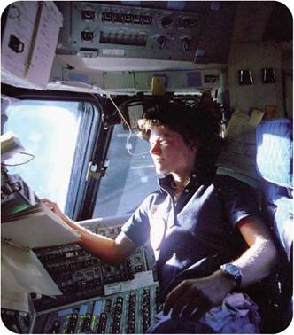
О Sally Ride, shown monitoring control panels on the Space Shuttle flight deck, was a Space Shuttle mission specialist in 1983.
|
out experiments. This flight made Ride the first American woman to fly twice in space. Fellow astronaut Kathryn Sullivan became the first American woman to walk in space.
Ride was assigned a further Space Shuttle flight in 1985 and began preparing for a launch the next year. That mission was canceled when, in January 1986, Challenger exploded shortly after takeoff. The Challenger disaster caused NASA to ban further Space Shuttle flights until the cause of the explosion could be determined. Ride was chosen to sit on the commission that investigated the accident.
 After that work was complete, she transferred to NASA headquarters in Washington, D. C., where she worked on long-range planning for the agency. Her Ride Report, issued in 1987, recommended using the technology of space exploration to study conditions on Earth. This Mission to Planet Earth, as it was called, has been undertaken by NASA. Much of the research focused on the issue of climate change. Another Ride recommendation was to begin planning for a mission to Mars. At the time, NASA did not pursue this plan, but instead focused its work on the International Space Station.
In 1987, Ride left NASA to accept a position at the Stanford University Center for International Security and Arms Control. Two years later, she joined the faculty of the University of California at San Diego, where she taught and carried out research in physics. For many years, Ride also directed the California Space Science Institute, although she left that post to focus on research, teaching, and her many other activities.
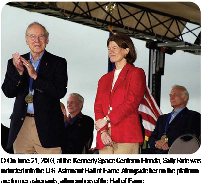
Over the next twenty years, Ride served on several government committees involved with space and technology. When the Shuttle Columbia exploded in 2003, NASA launched a new investigation. As with the Challenger incident, Ride was a member of the commission studying that accident.
Ride also dedicated herself to promoting interest in science and space exploration among young people, especially girls. She wrote several children’s books on space and took an active role in other efforts to build the popularity of space exploration. In 2001, she founded her own company, Sally Ride Science, to motivate girls and young women to pursue careers in science, math, and technology.
N
SEE ALSO:
• Astronaut • Challenger and
Columbia • NASA • Space Shuttle
_________________ J


 After that work was complete, she transferred to NASA headquarters in Washington, D. C., where she worked on long-range planning for the agency. Her Ride Report, issued in 1987, recommended using the technology of space exploration to study conditions on Earth. This Mission to Planet Earth, as it was called, has been undertaken by NASA. Much of the research focused on the issue of climate change. Another Ride recommendation was to begin planning for a mission to Mars. At the time, NASA did not pursue this plan, but instead focused its work on the International Space Station.

